Was the Eye of the Sahara the Real Atlantis?

A recent theory about Atlantis has become very popular among enthusiasts online. This theory seeks to associate Atlantis with the Eye of the Sahara, more formerly known as the Richat Structure. This is a fascinating structure in Northwest Africa which was discovered in the 20th century. It shares some interesting similarities to Plato’s description of the metropolis of Atlantis which has led many to conclude that this must be the origin of the story. In fact, many claim that it is an exact match with what Plato described. But does this claim, and surrounding ones, really stand up to scrutiny?
What Is the Eye of the Sahara?
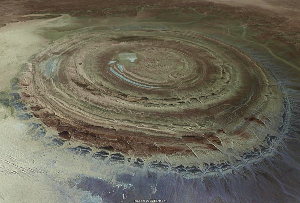
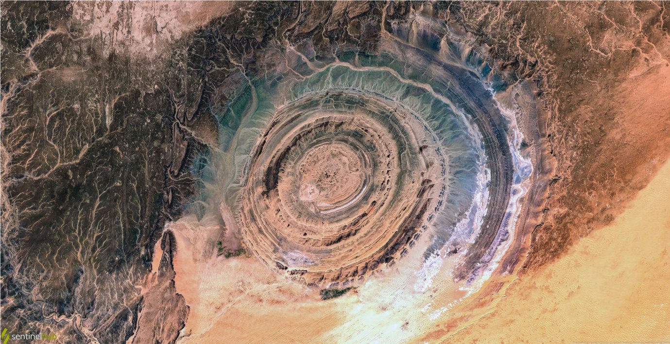
The Eye of the Sahara, or the Richat Structure, is located in Mauritania, Northwest Africa. It is a peculiar circular structure, made up of several concentric rings. It has a diameter of about 40 to 45 kilometres. Its location in the middle of the desert, far from any permanent settlements, has also contributed to the intrigue surrounding this site.
The Richat Structure was initially thought by many to be an impact crater, but subsequent research revealed that this could not be the case. Instead, geological research has revealed that the Eye of the Sahara has probably formed through a combination of erosion and uplifting from hydrothermal activity.
The Theory of Atlantis and the Eye of the Sahara
It seems that any location which involves concentric circles is immediately considered as a possible candidate for Atlantis, and that is exactly what has happened in the case of the Richat Structure. The theory that it is connected to Plato’s story of Atlantis is fundamentally rooted in a comparison of the layout of the structure with the details that Plato provides regarding the metropolis of Atlantis. Over time, surrounding evidence has also been supplied in support of the theory.
The Layout of the Richat Structure
Plato describes the metropolis of Atlantis as being made out of one small, central island, surrounded by three concentric zones of land, with water in between each zone. In this regard, the Richat Structure, or Eye of the Sahara, appears to fit Plato’s account remarkably well.
Although it is in the middle of the desert and there is thus no water around, the Richat Structure has what could be called an island in the centre, which is surrounded by three concentric rings of uplifted ground. If the gaps were filled with water, this would be a perfect match for what Plato described.
In addition, the size of the structure supposedly matches what Plato described. Depending on the exact two points chosen, the inner ‘island’ and the two surrounding rings of land measure to about 20 or 21 kilometres in diameter.
Plato said that the hill at the centre of the metropolis of Atlantis was 50 stadia distant from the sea. That would indicate a diameter of about 18.5 kilometres if the figure of 50 stadia is taken to be from the centre of the central hill. If taken from the edge of the hill, then one would need to also add the diameter of the hill itself. In any case, it is clear that the measurement from the Richat Structure is reasonably close to the diameter of Atlantis’ metropolis.
In addition, Plato explains that there was a channel through the rings of land, leading from the sea to the central island. In the Richat Structure, the land surrounding the outermost depression, beyond the two rings of land, is broken towards the southwest of the structure, providing an opening similar to what Plato described.
Colour of the Stones
A point which is often mentioned in arguments for a certain location being the true Atlantis is the colour of the stones used for building work. Plato says that the Atlanteans constructed buildings out of red, white and black stones, which they got from quarries in the area.
In and around the Richat Structure, there are rocks which are black, rocks which are reddish, and some which are lighter, arguably classified as ‘white’. On this basis, this arguably matches Plato’s description.
Ancient Civilisation
There is no surviving evidence for a grand civilisation in this region. However, a few artefacts have been found, demonstrating the presence of at least some groups of people at some point in the past. The fact that archaeologists do not know when these artefacts came from has been viewed as significant.
Furthermore, satellite imagery has revealed at least one manmade structure. No excavations have been performed, and the imagery merely reveals the basic outline of the structure, nothing more. Proponents of this theory argue that the destruction event (which we will examine later) wiped out all traces of the civilisation, stripping away the settlement essentially down to the bedrock.
Surrounding Geographical Features
In one part of the Critias, Plato mentions that there were mountains to the north. There are mountains to the northwest of the Richat Structure, which lends credence to the theory that the Eye of the Sahara was Atlantis.
Furthermore, Plato mentions that these mountains had rivers flowing down them. He remarks that the mountains had in them ‘many wealthy villages of country folk, and rivers, and lakes’. He later refers to ‘streams which came down from the mountain’. The mountains next to the Eye of the Sahara are totally barren, but there are what appear to be dried watercourses running down them, indicating that they had rivers on them in the past.
Another surrounding geographical feature is the famous plain of Atlantis. This was said to have been in the centre of the island. Since the circular metropolis was also described as being in the centre, one point of view would be that the plain was just next to the metropolis. Proponents of the Eye of the Sahara theory point out that there are large desert plains next to the Richat Structure.
Atlas, the First King of Mauritania
One piece of evidence for this theory which seems particularly strong is the connection with Atlantis. Plato explains that the first king of Atlantis was Atlas, the son of Poseidon. In fact, it was for this reason that it was called Atlantis.
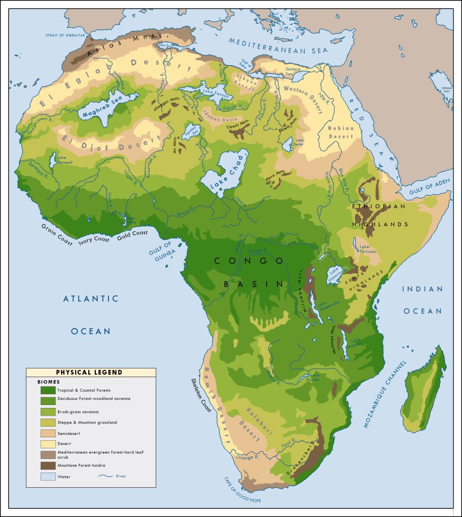
Many Classical Greek sources place Atlas, the Titan of Greek mythology who held up the sky, in Mauretania. He was particularly associated with the Atlas Mountains right in the north-western corner of Africa. This belief is found at least as early as Herodotus. Given that the Eye of the Sahara is in the modern country of Mauritania, this has been taken by many to be extremely significant.
In some later records, Atlas is even portrayed as the first king of Mauretania. Needless to say, this is very similar to Atlas the son of Poseidon being described by Plato as the first king of Atlantis.
Support from an Ancient Map
Another piece of evidence used in support of this theory is a supposed ancient map which shows the word ‘Atlantes’ in Northwest Africa, approximately at the location of the Eye of the Sahara.
This map, according to proponents of this theory, was created by Herodotus, the so-called father of history who lived in the fifth century BCE, even before Plato. This would appear to be direct support for the conclusion that Atlantis was in this region. And within this part of Africa, the only obvious match for Plato’s descriptions is the Eye of the Sahara, the Richat Structure.
Evidence that the Richat Structure Was Once an Island
One absolutely crucial part of this theory is the alleged evidence that this whole area used to be surrounded by water. After all, Atlantis was supposed to have been an island, not a city in the middle of the desert.
The Atlanteans ruled over one main island, several others, and parts of the continent. Atlantis itself is said to have been in the ‘Atlantic Sea’. Thus, this theory absolutely requires the Richat Structure to have once been surrounded by water.
At the moment, the Richat Structure is about 485 meters above sea level. Proponents of this theory argue that the entire Northwest corner was formerly in the sea, and that seismic activity caused this portion of the continent to rise up over the millennia.
By way of comparison, they have pointed out that Antarctica is rising up at a rate of about 41 millimetres per year. After 11,600 years (the supposed age of Atlantis according to Plato’s account), this would total 476 meters, which is near enough the height of the Richat Structure.
Seismic Activity
In the case of the Richat Structure, it is known to be strongly connected to seismic activity. After all, seismic activity of a sort was partially responsible for its creation. This activity is specifically related to uplifting.
This has been used to argue that this is a known area of uplifting activity, thus meaning that it is entirely possible that this region had a lower elevation in the past.
Presence of Salt within the Richat Structure
Something which is used as definitive proof that the Richat Structure formerly had seawater inside the rings is the presence of salt within the structure. The argument is that this could only be the result of seawater having filled these depressions in the past and then evaporated after a long time.
There are also a number of other locations in the same general region which show high concentrations of salt, such as inside a nearby volcanic crater. In fact, the entire region of Northwest Africa has many salt deposits. For this reason, it has long been a hugely important location in the salt trade across Africa. This is used as evidence that this entire region was formerly underwater.
Surrounded by Lakes and Rivers
One alternative to this explanation that has been suggested is that the word ‘island’ in Plato’s account was not intended to be understood as meaning an actual island in the modern sense of the word. The word Plato used was ‘nesos’. This is normally translated as ‘island’, but there is evidence that this was also used for ‘peninsula’ at times, particularly before the era of Herodotus.
For example, the Peloponnese is a peninsula, but the very name means ‘Island of Pelops’. Of course, Northwest Africa is not a peninsula either. However, one researcher claims that the word ‘nesos’ could also be used for ‘a land within a continent, surrounded by lakes, rivers or springs’.
On the basis of this definition, it is claimed that the Eye of the Sahara and the surrounding area may have been viewed as a ‘nesos’, or type of ‘island’, some 11,600 years ago, when the story of Atlantis is supposedly set. In that era, scientists believe that Africa was experiencing a humid period, in which much of the Sahara desert was covered with lush vegetation, lakes, and rivers.
Evidence for Destruction by Water
One of the most famous and important parts of the tale of Atlantis is the fact that it was wiped out by a major destruction event. According to Plato,
“there occurred violent earthquakes and floods; and in a single day and night of misfortune… the island of Atlantis in like manner disappeared in the depths of the sea.”
Naturally, one major objection to this theory is that the Eye of the Sahara is not ‘in the depths of the sea’. In fact, as we saw previously, it is 485 meters above sea level. However, proponents of this theory argue that Plato’s description is consistent with Atlantis being wiped out by a giant tsunami.
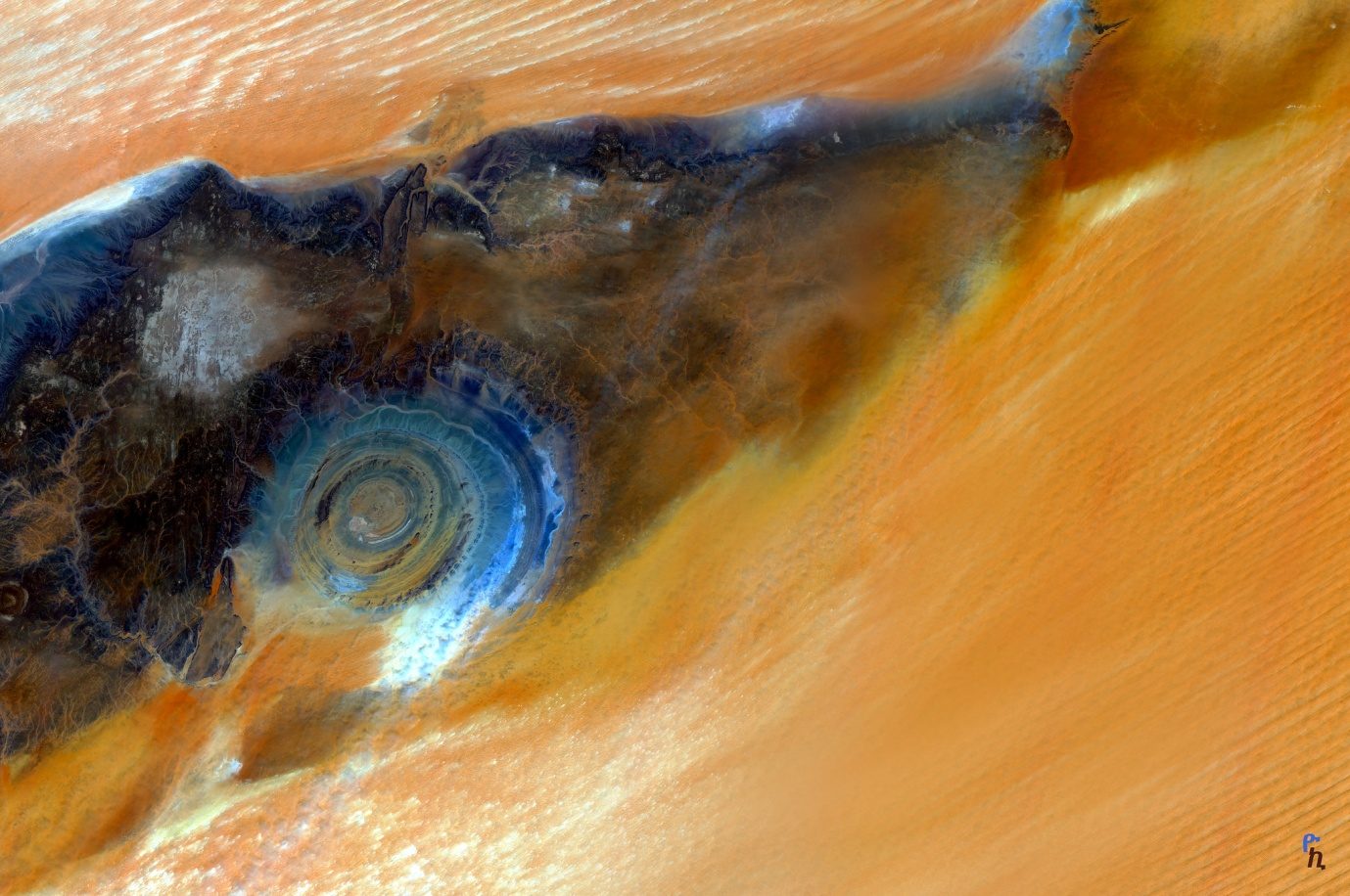
This theory argues that a tsunami from the Atlantic Sea swept across Northwest Africa and utterly destroyed the Atlantean civilisation that formerly existed there. The primary piece of evidence for this is the fact that satellite imagery of the region shows what appears to be sand that has been swept all across the region by flowing water.
The Date of This Destruction
Another crucial issue is the question of when this destruction by water took place. The destruction of Atlantis, according to Plato’s account, occurred about 11,600 years ago. Interestingly, an eruption from a nearby volcano (the same one which has salt deposits in the crater, mentioned earlier) left the surrounding area scorched and marked by the volcanic material.
This eruption is thought to have occurred approximately 11,000 years ago, roughly consistent with the date of Atlantis. Significantly, the seemingly water-swept sand flows right past this and actually appears to cut through the outer edge of the dark surrounding material on one side of the volcano.
This would have to mean that the flow of water that swept the sand along came sweeping through this region no earlier than the date of the volcanic eruption. This would place the apparent tsunami at about the right time for the story of Atlantis.
Problems with This Theory
Despite the common claims that the Eye of the Sahara is an exact match for the description of Atlantis in Plato’s account, this is far from the case. Let us now consider a deconstruction of the aforementioned evidence and show how it is flawed.
The Measurements
While it might seem, at first glance, like there is an amazing correspondence between the size of Atlantis and the size of the Richat Structure, this relies on very selective cherry-picking. The measurement given for the diameter of the metropolis of Atlantis is about 100 stadia, plus the diameter of the central hill if Plato did not already include that in the measurement.
This measurement includes the three surrounding rings of land and the three rings of water that divided them. So, the entire circular island, all three zones of land and water included, had a diameter of 100 stadia, or about 18.5 kilometres.
While this is claimed to be a match for the Richat Structure, the measurement given for that structure actually only takes in the first two rings of uplifted land. When the depression and final ridge outside those two rings are included (to match Plato’s description of three rings of land and water), the diameter is seen to actually be about 41 kilometres. This is more than twice the size of what Plato describes.
The Outer Passage
The supposed match between the channel described by Plato and the break in the final ridge of uplifted land at the Richat Structure also does not work. Plato describes this channel as cutting through all three rings of land, to provide access to the central island from the sea.
In contrast, the gap in the outer ridge is just that, a gap in the outer ridge. It does not go through all three ridges, as in Plato’s description of the channel cutting through all three rings of land.
No Traces of an Ancient Civilisation
The arguments used by proponents of this theory are somewhat contradictory. On the one hand, the lack of evidence for remains of an ancient civilisation here is dismissed as being due to the massive tsunami sweeping through this region, tearing away the settlement right down to the bedrock.
On the other hand, proponents of this theory have tried to use as evidence the satellite image of a single angular building to show that there was a settlement here. Obviously, the two arguments cannot both be true. If the tsunami wiped out everything, then the building revealed by satellite imagery cannot be from the pertinent settlement. But if it is from the Atlantean civilisation, then we would expect there to be far more traces all over the Richat Structure than there are.
Regarding the few isolated artefacts that have been found, these likewise indicate that if there really had been a powerful civilisation here in the past, then traces of it would be found beyond just one or two types of simple artefacts. The evidence as it is, then, is far more consistent with passing groups of relatively simple nomads, of which there were many in the Sahara desert.
The Non-Existent Plain
The plain near the Eye of the Sahara which supposedly matches Plato’s plain of Atlantis is also non-existent. That is to say, this region is surrounded by plains inasmuch as it is in the desert. The desert opens up to the east into what could arguably be called a plain, but it is not defined whatsoever by surrounding features.
It is just empty land that opens up in all directions. It is nothing like the rectangular plain surrounded by mountains, with specific measurements, described by Plato.
The Truth Behind Atlas, First King of Mauretania
The correspondence between this location and the existence of Atlas, the first king of Mauretania, seems at first like a striking piece of evidence. However, it falls down when examined further. Firstly, the character of Atlas in Plato’s account is not presented as the same person as Atlas of standard Greek mythology.
Plato’s Atlas is a demigod, the son of Poseidon and a human woman. In contrast, Atlas from Greek mythology is a Titan, a race older than the gods. He is the son of the Tian Iapetus. Rather than being given an island to rule, his function is to hold up the sky. The two figures bear no relation to each other.
Furthermore, Atlas the Titan was not always placed at Northwest Africa. In fact, there is evidence that he was originally placed on the west coast of Greece, in or near Thesprotia in particular, as well as other locations within the Greek world. As the Encyclopedia Britannica notes:
“In Homer’s Odyssey, Book I, Atlas seems to have been a marine creature who supported the pillars that held heaven and earth apart. These were thought to rest in the sea immediately beyond the most western horizon, but later the name of Atlas was transferred to a range of mountains in northwestern Africa.”
Additionally, the Mauretania of which Atlas was later described as king was not the same location as the modern-day country of Mauritania. The modern-day country is much further south than the ancient territory. From the Eye of the Sahara to the southernmost part of the Atlas Mountains is over 800 kilometres. To the main portion of it, the distance could be considered well over 1500 kilometres. This is greater than the distance between Barcelona and Berlin.
The ‘Map’ Placing Atlantis in Northwest Africa
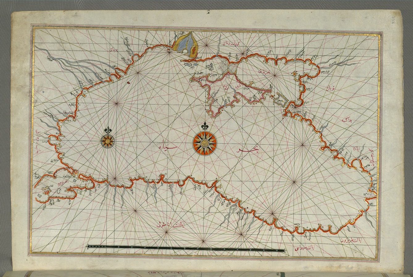
The argument that there is an ancient map which places Atlantis in Northwest Africa is similarly confused. The map in question was created long after the time of Herodotus, but it is based on Herodotus’ written description of the world.
The reference to ‘Atlantes’ on the map is not a reference to a location. A quick glance at the rest of the map shows that it, like countless other names on it, is the name of a people, not a place. In his Histories, Herodotus describes a people in Northwest Africa who lived near Mount Atlas (a prominent peak in the Atlas Mountain range).
Due to them living next to Mount Atlas, they were called the Atlantes. While one could argue for a connection between this name and Plato’s Atlantis, this would really be a connection no greater than that possessed by any other people or place associated with Atlas, of which there were originally many.
Besides, this people were placed by Herodotus in the vicinity of Mount Atlas, well over 1500 kilometres away from the Eye of the Sahara.
Was the Richat Structure Really an Island?
One of the most crucial parts of this theory is the argument that the Richat Structure was originally an island, the entire region of Northwest Africa having been at sea level thousands of years ago. As we have seen, one main piece of evidence used in support of this is the presence of large quantities of salt inside the Richat Structure.
The problem with this argument is that it does not require the Richat Structure to have formerly been at sea level. The sea is not the ultimate source for salt. In fact, the sea has salt in it because rivers wash it down from the land, where salt is naturally found.
Large beds of salt can form by the drying up of lakes. Satellite imagery does show that rivers used to flow down over the mountains around the Richat Structure, so it is not unlikely that there were bodies of water inside the Richat Structure during the African humid period. As this water dried, this would have left salt pans within the structure. Nonetheless, none of this indicates that this section of the continent was formerly at sea level.
Flaws in the Arguments
Additionally, consider the argument that Antarctic is rising at a rate of 41 millimetres per year. Does this mean that the same could have happened to Northwest Africa? In reality, the reason this is happening with Antarctica is because of the fact that its covering of ice is melting. Thus, the weight pressing down on it is easing up, allowing the continent to rebound.
Since the proposed process involved in the raising of Northwest Africa involves a completely different process, the speed of the raising of Antarctica is irrelevant and cannot be used as evidence.
The proposed process in question is volcanic activity. Since the Richat Structure appears to have been formed by magma beneath the surface pushing the rock up, it is argued that the region is associated with uplifting. Hence, the logic goes that it is plausible that Northwest Africa could have been pushed up over the millennia.
The obvious flaw in this logic is the fact that the uplifting in question just involved the Richat Structure itself, not the entire northwest portion of the continent of Africa.
Did ‘Nesos’ Not Really Mean an Island?
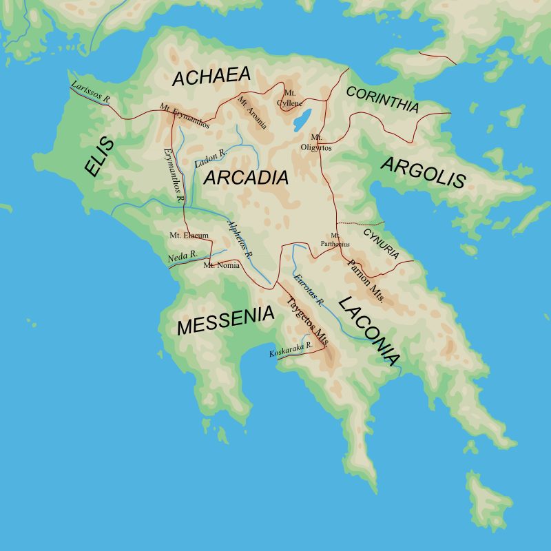
What about the argument that the word Plato used, ‘nesos’, did not really mean ‘island’? According to this line of reasoning, the Richat Structure was an ‘island’ in the sense that it was in an area surrounded by lakes and rivers.
There are two problems with this. One problem is that this lesser-known definition for ‘nesos’ appears to originate with Stavros Papamarinopoulos, an Atlantis researcher who argues for Atlantis in Spain. While the use of ‘nesos’ for ‘peninsula’ is legitimate, the idea that it could be used for any region surrounded by lakes and rivers is not a well-sourced claim.
Even if we accept this definition, Plato’s account precludes it. He clearly places the island of Atlantis in ‘the Atlantic Sea’. If the ‘nesos’ of Atlantis was in the Atlantic Sea, then the ‘nesos’ in question must be an actual island, or perhaps a peninsula, but nothing less than that.
Plato also contrasts the islands ruled by Atlantis with the ‘parts of the continent’, which they also ruled. This, again, shows that the island of Atlantis was not, itself, part of a continent.
The Problem with the Supposed Destruction
We encounter another problem with this theory when it comes to the supposed destruction. The evidence for the giant tsunami sweeping across Northwest Africa is primarily the aerial appearance of the sand in the region. It does look as though water has swept over it.
One problem with this is that it contradicts the concept of the Richat Structure originally having been an island. If the surrounding land in Northwest Africa was under the sea thousands of years ago when this supposed destruction took place, then the tsunami could not have swept over that land, since it would have already been underwater.
Therefore, proponents of this theory can only do one of two things. They can either argue that Atlantis was not an island, thus allowing them to use the appearance of the land surrounding the Eye of the Sahara as evidence of the supposed tsunami. Or, they can argue that the surrounding land was underwater. However, they cannot argue for both at the same time, as they are mutually exclusive.
As we have just seen, Plato definitely described Atlantis as an island, or a peninsula at the very least, since he places it in ‘the Atlantic Sea’. Thus, the argument that the Eye of the Sahara would match Atlantis even without being an island is simply not viable.
Thus, the supposed evidence for water destruction, if it should really be interpreted as such, is actually evidence against the Eye of the Sahara being Atlantis, since it would be evidence that the hypothetical settlement here was on dry ground when it was destroyed.
Alternative Explanations for the Appearance of the Sand
The reality, though, is that the appearance of the surrounding land as seen in satellite pictures is not evidence of a mega-tsunami sweeping through the land. A close examination of the evidence shows that this appearance is caused by the wind. In fact, what is seen in the surrounding land is actually a dune field of which NASA conducted a brief analysis.
Some interesting comments include the following:
“Extensive sand dunes occur in this region and the interaction of bedrock topography, wind, and moving sand is evident in this scene. Note especially how the dune field generally ends abruptly short of the cliffs as wind from the northeast (upper right) apparently funnels around the cliff, sweeping clean areas near the base of the cliff (particularly at the cliff point to the northwest, upper left, of the Richat Structure).”
As we can see, the environment surrounding the Eye of the Sahara is well explained as a phenomenon caused by a windswept environment, not a water-swept one.
Conclusion
The theory that the Eye of the Sahara, or the Richat Structure, was the origin behind Atlantis is based primarily on perceived similarities between the structure and Plato’s description of the metropolis of Atlantis. This theory fails to take into account the majority of other pieces of information provided by Plato, focusing almost entirely on the description of the metropolis. For this reason, the Eye of the Sahara theory entirely fails to take into account aspects such as the war against the Greeks, the bull hunting and the naval empire.
However, even the supposed similarities with the metropolis of Atlantis are based on very selectively cherry-picking the evidence, and in some cases they are mutually contradictory. For instance, the design of the structure and the size of the structure cannot both be argued to match Atlantis. Similarly, the argument that this structure was formerly surrounded by water and that the appearance of the surrounding land shows that a tsunami swept over this area is based on two mutually exclusive ideas.
Sources
https://www.siwasaltgroup.com/sahara-salt
https://atlantipedia.ie/samples/island-peninsula-or-continent/
https://www.britannica.com/topic/Atlas-Greek-mythology
https://www.arcus-atlantis.org.uk/atlantis/atlanteans-in-africa.html
https://theness.com/neurologicablog/no-atlantis-has-not-been-discovered-in-north-africa/